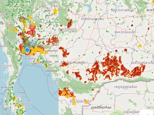
Thailand's Geo-Informatics and Space Technology Development Agency (GISTDA) released satellite imagery on 25 Sept showing widespread high-risk flood zones across central, northeastern, northern and southern regions. Using real-time geospatial data via the "Chek Nam" app, GISTDA identified critical risk areas (red zones) spanning Nakhon Sawan, Phichit, Phetchabun, Lopburi, Saraburi, Suphan Buri, Pathum Thani, Nonthaburi and parts of Bangkok, plus lower northeast provinces including Surin, Si Sa Ket, Buriram and Roi Et. The satellite-derived flood monitoring is enabling water management authorities, civil defense, and local agencies to coordinate drainage operations and emergency response effectively.